Bhiwkund Maharashtra Lower Cave Veranda Inscription (INNAG0037)

Cave near Bhiwkund Village, Maharashtra, India (21.052010, 79.45922)
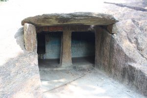
Bhiwkund Maharashtra Lower Cave (OBNAG0036)

Cave near Bhiwkund Village, Maharashtra, India (21.052010, 79.45922)
Bhiwkund Maharashtra Main Cave Broken Veranda Inscription (INNAG0036)

Cave near Bhiwkund Village, Maharashtra, India (21.052010, 79.45922)
Bhiwkund Maharashtra Main Cave Veranda Inscription (INNAG0035)

Cave near Bhiwkund Village, Maharashtra, India (21.052010, 79.45922)
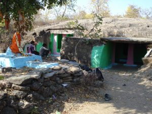
Bhiwkund (Maharashtra) Main Cave (OBNAG0035)

Cave near Bhiwkund Village, Maharashtra, India (21.052010, 79.45922)
Bhiwkund (Maharashtra) Main Cave Inscription (INNAG0034)

Cave near Bhiwkund Village, Maharashtra, India (21.052010, 79.45922)
IN03051 Riṭigala Vēväl-tänna Cave Inscription
The hill-range of Riṭigala is located about twenty-five miles south-east of Anurādhapura and eighteen miles north-east of Dam̆bulla. The range has numerous caves, rocks, ruins and inscriptions. Wickremasinghe describes four groups of inscriptions at different locations in the mountain range:
[1] Āṇḍiyā-kanda (east spur) – 10 cave-inscriptions.
[2] Karam̆bǟ-hīnna (north-west spur) – 2 cave-inscriptions (of which only one is described by Wickremasinghe).
[3] Nā-ulpata, also called Nā-arambädda-hīnna (west and south-west spur) – 1 cave-inscription; 4 rock-inscriptions (of which only three are described by Wickremasinghe).
[4] Vēväl-tänna (lower eastern spur) – 1 cave-inscription; 1 rock-inscription.
OB03030 Riṭigala Nā-ulpata Cave
The hill-range of Riṭigala is located about twenty-five miles south-east of Anurādhapura and eighteen miles north-east of Dam̆bulla. This commanding position, as well as the shelter which the mountain’s numerous rocks and caves afford, may account for its importance in ancient times, both as a stronghold of contending clans and as a place of refuge for fugitive princes and religious devotees. The name of the mountain range may be derived from the site’s trees (Sinh. ‘riti’), from the Pali name ‘Arittha’ (‘safety’, in reference to the range’s function as a place of shelter) or even from Maha Arittha, the chief minister of King Devanampiya Tissa (reg. c. 250-210 B.C.). The range has numerous caves, rocks, ruins and inscriptions. Two of the inscriptions name the area as ‘ariṭa-gama’, confirming the identification of the site as Ariṭṭa-pabbata (or -sēla), a mountain range mentioned in the Sri Lankan chronicle, the ‘Mahāvaṁsa’. The range has also been associated with Mt Aristha of the Indian epic the ‘Rāmayana’.
IN03047 Riṭigala Nā-ulpata Cave Inscription
The hill-range of Riṭigala is located about twenty-five miles south-east of Anurādhapura and eighteen miles north-east of Dam̆bulla. The range has numerous caves, rocks, ruins and inscriptions. Wickremasinghe describes four groups of inscriptions at different locations in the mountain range:
[1] Āṇḍiyā-kanda (east spur) – 10 cave-inscriptions.
[2] Karam̆bǟ-hīnna (north-west spur) – 2 cave-inscriptions (of which only one is described by Wickremasinghe).
[3] Nā-ulpata, also called Nā-arambädda-hīnna (west and south-west spur) – 1 cave-inscription; 4 rock-inscriptions (of which only three are described by Wickremasinghe).
[4] Vēväl-tänna (lower eastern spur) – 1 cave-inscription; 1 rock-inscription.
OB03029 Riṭigala Karam̆bǟ-hīnna Caves
The hill-range of Riṭigala is located about twenty-five miles south-east of Anurādhapura and eighteen miles north-east of Dam̆bulla. This commanding position, as well as the shelter which the mountain’s numerous rocks and caves afford, may account for its importance in ancient times, both as a stronghold of contending clans and as a place of refuge for fugitive princes and religious devotees. The name of the mountain range may be derived from the site’s trees (Sinh. ‘riti’), from the Pali name ‘Arittha’ (‘safety’, in reference to the range’s function as a place of shelter) or even from Maha Arittha, the chief minister of King Devanampiya Tissa (reg. c. 250-210 B.C.). The range has numerous caves, rocks, ruins and inscriptions. Two of the inscriptions name the area as ‘ariṭa-gama’, confirming the identification of the site as Ariṭṭa-pabbata (or -sēla), a mountain range mentioned in the Sri Lankan chronicle, the ‘Mahāvaṁsa’. The range has also been associated with Mt Aristha of the Indian epic the ‘Rāmayana’.